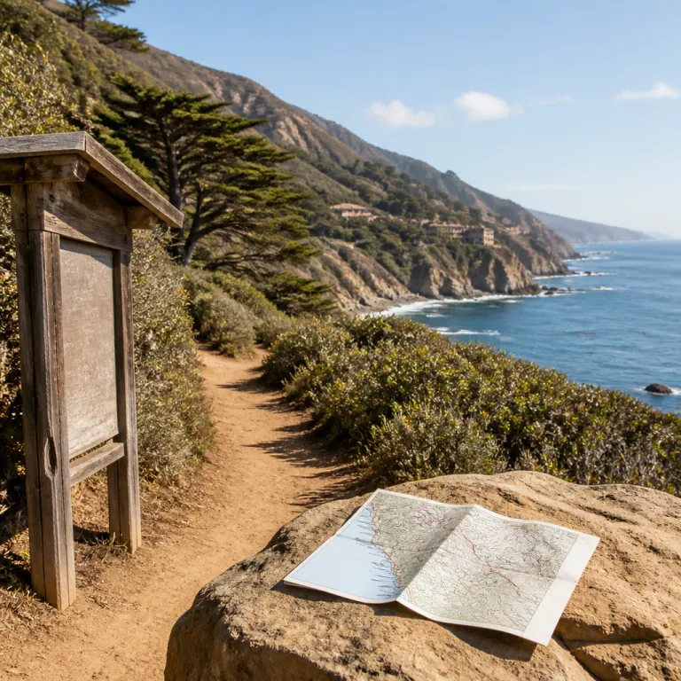
Why your hotel choice should follow the Big Sur hiking trails map
Choosing a hotel in Big Sur is easier when you first study a detailed Big Sur hiking trails map or trail overview. When you understand how each route connects to Highway 1, to every state park, and to the coastal drive, you can match your stay to the landscapes you most want to explore. This approach turns a simple room booking into a curated base for hikes measured in miles rather than minutes lost in traffic.
Many travellers arrive with a vague idea of a famous beach or a redwood grove but no clear map of how far each trail lies from their chosen hotel. By overlaying your preferred hikes and the main state parks on a printed or digital map, you can see whether a property sits closer to Pfeiffer Big Sur redwood landscapes, to Point Lobos headlands, or to the quieter Limekiln State Park forests. That clarity matters when you plan early starts, sunset views, and a comfortable round trip back to your room.
Hotels near the central stretch of Big Sur often offer the best balance between access to Julia Pfeiffer Burns, Andrew Molera, and Pfeiffer Big Sur areas. From this central zone, the drive to either a beach trail or a high elevation ridge walk usually stays under an hour, which is ideal if you want to return for spa time or dinner. As one local manager at Big Sur Lodge notes, “Guests who arrive with a marked-up map end up seeing more and driving less.” Ask the front desk for on-the-ground info about current trail conditions before committing to a long-mile day.
Reading the coast: how maps shape your stay along Highway 1
Along this dramatic Big Sur coast, the relationship between your hotel and any hiking map is defined by Highway 1. Every major state park, from Andrew Molera State Park to Julia Pfeiffer Burns State Park and Limekiln State Park, anchors a cluster of trails that fan inland from the highway and down toward the beach. When you choose a hotel, you are really choosing which of these clusters will frame your mornings and your sunset views.
North of the main Big Sur village, properties closer to Point Lobos State Natural Reserve and the Carmel Highlands coastline suit guests who prefer shorter hikes with modest elevation gain. Here, the map shows compact loops of only a few miles, such as the Cypress Grove Trail or Sea Lion Point Trail, ideal for a relaxed round trip before a long lunch back at your room. South of the village, hotels near Julia Pfeiffer Burns and Pfeiffer Big Sur areas place you closer to longer trails that climb above the Big Sur River and through dense redwood forests.
Parking access also changes dramatically along the drive, and your map should highlight lots that fill early near each state park. Some hotels provide printed maps with parking icons and estimated mile distances to key trailheads, such as the Pfeiffer Falls trailhead or the Andrew Molera main lot, which helps you decide whether to walk from the property or plan a short drive. Before you book, ask whether the front desk team can mark their favourite trails directly on a map so you can visualise each day, including approximate drive times between your hotel and the nearest state parks.
Staying near Pfeiffer Big Sur State Park and the redwood heartland
Guests who want to wake among redwood silhouettes often focus on lodging near Pfeiffer Big Sur State Park. On any regional hiking map, this state park appears as a dense knot of trails that weave along the Big Sur River, climb toward Pfeiffer Falls, and connect with the popular Valley View and Buzzard’s Roost routes. Staying nearby reduces your drive time and lets you step from your room to the trail within minutes.
Within this Big Sur state landscape, the best hotel choices for hikers usually sit either along the river corridor or on the slopes above the park. Properties in the valley offer cooler air and easy access to family-friendly hikes of only a mile or two, while hillside stays trade that convenience for sweeping views and slightly longer drives to parking areas. When you review a map, note both the official state park boundaries and the informal access paths that some lodges maintain for guests.
Trail conditions in the Pfeiffer Big Sur area can change quickly after storms, so your hotel’s ability to provide fresh info is as valuable as its proximity. Many front desks now consult online platforms such as Big Sur Trailmap.net and AllTrails, where notes such as “Trail conditions updated regularly” and “Seasonal variations affect trail accessibility” appear for specific routes. This blend of digital data and local knowledge helps you choose whether to attempt a longer round trip with significant elevation gain or to enjoy shorter trails near the river; California State Parks trail descriptions and Big Sur Trailmap.net both emphasise that conditions can shift rapidly after winter weather.
Oceanfront stays for beach walks, Point Sur, and Julia Pfeiffer views
If your ideal stay revolves around ocean soundtracks, choose hotels that sit closer to the coast than to the inland redwood valleys. On a Big Sur hiking map, these properties align with icons for Point Sur, Julia Pfeiffer Burns, and the scattered beach access points that dot the highway. From here, you can pair a morning climb to a headland with an afternoon stroll along a sheltered beach without a long drive.
Julia Pfeiffer Burns viewpoints and the surrounding state park trails are among the most photographed in California, so staying nearby helps you reach them before the parking lots fill. The map will show short but steep paths with notable elevation gain, often less than a mile each way but demanding on the return leg, such as the Overlook Trail to McWay Falls. Hotels in this corridor should be ready with tide info, safety guidance, and suggestions for less crowded hikes that still deliver the same Pacific views.
Farther south, near Limekiln State Park and the quieter southern Big Sur coastline, you will find fewer rooms but a more secluded atmosphere. Here, trails often combine forested segments with beach access, creating varied round trip options that range from a gentle two miles to more ambitious hikes. When you compare hotels, ask which state parks they sit closest to on the map and how long the drive usually takes in real traffic; for instance, a stay near Gorda can mean roughly 15 to 25 minutes by car to Limekiln trailheads, depending on conditions.
Planning daily hikes from your hotel: miles, elevation gain, and timing
Once you have chosen a hotel, the next step is to use a Big Sur trail map to design realistic daily itineraries. Start by listing the trails you most want to walk, then note each mile length, expected elevation gain, and the distance in kilometres from your hotel’s parking area. This simple exercise prevents over-ambitious plans and ensures you return in time for dinner or a sunset drink.
For example, a guest staying near Andrew Molera might pair a gentle beach trail of only a few miles with a moderate inland loop that climbs above the Big Sur River. Another guest based closer to Point Lobos headlands could focus on shorter coastal hikes, each less than a mile or two, but string several together for a satisfying round trip day. In both cases, the map becomes a bridge between your room key and the best landscapes of Big Sur, especially when you sketch a simple table of trail name, distance, and elevation gain before you leave the hotel.
Trail conditions should guide your choices as much as distance numbers, especially after heavy rain or strong surf. Before setting out, confirm info with your hotel reception and cross-check it with online platforms that specialise in state parks and local trails. Many properties now keep printed maps in the lobby, marked with staff favourites and notes on where the views are most impressive at different times of day; Big Sur Lodge, for instance, often highlights Pfeiffer Falls and Valley View as half-day options for guests.
Safety, sustainability, and using digital maps while staying in Big Sur
Responsible hiking begins in your hotel room, with a careful reading of both printed and digital versions of a Big Sur hiking trails map or GPS-based guide. The region offers well over 150 miles of marked routes across dozens of distinct trails, according to California State Parks and local planning documents, so a thoughtful plan helps you stay safe while enjoying the best of each state park. Always match your chosen trail to your fitness level, paying close attention to elevation gain and the availability of water along the way.
Many hotels encourage guests to download offline maps before leaving, because mobile coverage along the drive can be unreliable between Point Lobos and Limekiln State Park areas. Platforms such as Big Sur Trailmap.net and AllTrails combine GPS navigation with user reports on trail conditions, which is particularly useful in remote Julia Pfeiffer Burns and Andrew Molera sections. When you return, consider sharing your own observations with the front desk so they can update info for the next wave of hikers.
Environmental care is central to the long-term health of Big Sur and its state parks, from Pfeiffer Big Sur to Julia Pfeiffer Burns and beyond. Stay on established trails, respect parking limits, and avoid trampling fragile vegetation near cliff edges or along the falls trail corridors. By aligning your hotel choice, your map reading, and your behaviour on the ground, you help ensure that these views remain unspoiled for future guests.
Key figures for hotel guests using Big Sur hiking maps
- Big Sur offers well over 150 miles of official hiking trails, spread across coastal headlands, redwood canyons, and inland ridges, according to California State Parks and regional tourism data; California State Parks trail brochures and Big Sur Trailmap.net both reflect this extensive network.
- There are several dozen mapped routes in the wider Big Sur area, which means hotel guests can choose from short walks under 2 miles to full-day round trip hikes.
- Most popular state parks, including Pfeiffer Big Sur State Park, Andrew Molera State Park, Julia Pfeiffer Burns State Park, and Limekiln State Park, sit directly along Highway 1, usually within a 10 to 40 minute drive of central lodging areas.
- Digital platforms that provide Big Sur hiking trail data report year-round usage, with trail conditions updated regularly to reflect seasonal closures and weather impacts.
FAQ: Big Sur hiking maps and hotel planning
Where can I find a reliable map of Big Sur hiking trails ?
For a comprehensive Big Sur hiking trails map, guests often start with Big Sur Trailmap.net, which offers interactive coverage of major state parks and lesser-known trails. Many hotels also provide printed maps at reception, marked with staff recommendations and estimated miles for popular routes. Combining both sources gives you a clear picture of distances from your room to each trailhead, and California State Parks brochures add official trail descriptions.
Are there easy hiking trails near most hotels in Big Sur ?
Yes, many hotels sit within a short drive of gentle trails in Pfeiffer Big Sur State Park, Andrew Molera State Park, and Point Lobos State Natural Reserve. These areas feature well-signed paths under 5 miles with limited elevation gain, suitable for families or relaxed walkers. When you check in, ask the front desk to highlight the easiest options on a map based on your fitness level.
How do I check current trail conditions before leaving my hotel ?
The most efficient approach is to combine local knowledge with digital tools that specialise in Big Sur hiking trails map updates. Reception teams often receive notices about closures in Julia Pfeiffer Burns, Limekiln State Park, and other state parks, while online platforms such as AllTrails provide user reports on mud, fallen trees, or washed-out sections. Reviewing both sources each morning helps you avoid unsafe routes and wasted drives.
Is parking difficult at popular Big Sur trailheads ?
Parking can be challenging at peak times, especially near Point Lobos, Pfeiffer Big Sur, and Julia Pfeiffer viewpoints along Highway 1. Many hotels advise guests to arrive early, to carry cash or cards for state park fees, and to have a backup trail marked on the map in case lots are full. Planning a flexible round trip schedule reduces stress and keeps your day focused on views rather than queues.
Should I rely on digital navigation or carry a printed map as well ?
Because mobile coverage in Big Sur is inconsistent, it is wise to download offline maps and to carry a printed Big Sur hiking trails map from your hotel. Digital tools excel at showing your exact position on a trail, while paper maps give a broader overview of distances between state parks, beaches, and your lodging. Using both together offers the most reliable guidance for safe and enjoyable hikes.
Trusted references for further trail and map information
For deeper, regularly updated information about Big Sur trails and maps, consult Big Sur Trailmap.net, AllTrails, and the official California State Parks resources for Pfeiffer Big Sur, Andrew Molera, Julia Pfeiffer Burns, Limekiln, and Point Lobos; these sources provide current trail mileage, elevation profiles, and notes on seasonal closures.