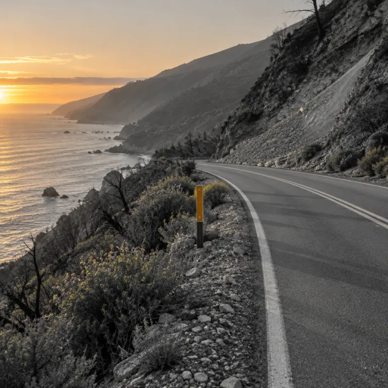
Visiting Big Sur after fire: why going back matters
Visiting Big Sur after fire is not a carefree coastal fantasy; it is a decision about whether you help a fragile place recover or quietly abandon it. Highway 1 through this stretch of the California coast only fully reopened in mid-January 2026 after nearly three years of landslide damage, and within months the Timber Fire forced fresh closures that reminded visitors how quickly access can vanish again. The pattern is now familiar along this Big Sur shoreline, where fires and slides arrive in cycles and the question is not if another blaze will start in the backcountry, but how the community weathers the aftermath.
Think of the road as a living experiment in climate adaptation rather than just a scenic drive, because Caltrans crews, geologists and local businesses have turned every repair into a test of what might hold against the next storm or wildfire. Caltrans summary data on the Dolan and Paul’s Slide repairs indicate that emergency work along this stretch of Highway 1 since the major slide has cost well over one hundred million dollars, while regional economic impact assessments for Monterey and San Luis Obispo counties estimate that tourism losses climbed far higher as rooms sat empty and state parks stayed quiet. When you choose to stay in a hotel at the north or south ends of Big Sur after the Timber Fire, you are helping to keep staff on payroll in a region where nearly half a billion dollars in economic activity evaporated during the long closure period.
Some travelers worry that returning to Big Sur after fire is selfish, yet staying away entirely can be its own kind of harm. Inns, cafés and spiritual centers along the Big Sur River corridor and the ridges above rely on shoulder-season bookings, and blanket cancellations after headlines about wildfires or landslides punish the very people who kept the coast alive when the highway was cut. The ethical line is not between going and not going, but between visitors who respect closures, listen to Cal Fire updates and avoid closed trails in Los Padres National Forest, and those who treat a burn scar as a backdrop for content.
Local agencies are clear about the new travel contract, and their own words are worth repeating without spin. “Is Highway 1 open through Big Sur now?” and “Are wildfires still a risk?” are not abstract questions when you are choosing a hotel, and the official answer from Caltrans and Cal Fire is blunt: “Yes, since January 2026 following a nearly three-year closure.” “Yes; recent fires like Plaskett and Timber continue to threaten safety and access.” “How should visitors act responsibly?” is the third question, and the guidance from state parks and county emergency managers is equally direct: “Monitor road alerts, follow restrictions, support locals and reduce impact.”
For you as a road trip planner, that means booking where access is stable and trails are genuinely open, not where a map app still shows a line through a burn. The northern gateway near Carmel gives you reliable entry to Pfeiffer Big Sur State Park and the lower Pfeiffer Falls Trail when conditions allow, while the southern approach from Cambria connects you to the Los Padres National Forest segments that typically reopen first after Plaskett-area fires or slides. In both directions, traveling through Big Sur after fire is less about chasing every overlook and more about accepting that some sections will remain closed, and that your role is to enjoy what is open without pushing the edges.
Choosing where to stay when closures keep shifting
Hotel choice in Big Sur after fire is no longer just about the view; it is about how you position yourself around a moving puzzle of closures, detours and reopened trails. When a Timber Fire flare-up or a series of Plaskett-area fires ignite in the backcountry, Cal Fire and Los Padres National Forest managers may shut down long stretches of Pine Ridge Trail or entire blocks of state park campgrounds, leaving only certain pockets of lodging with practical access to hiking. The smartest move is to treat your stay as a base camp for specific open areas rather than a central hub for the entire coast, because exploring Big Sur after fire means accepting that some ambitions will wait for another trip.
On the north side, properties near Carmel and the gateway to Pfeiffer Big Sur State Park give you the best odds of reaching classic routes like the Pfeiffer Falls Trail or the valley floor loops when they are declared safe. Before you book, cross-check the California State Parks website with Los Padres National Forest alerts to see which trails remain closed and which ridge trail segments are open for day use, then match your hotel to that map instead of to a generic Big Sur label. If you are planning mostly gentle walks, use a resource like this guide to easy hikes in Big Sur and how to choose the right hotel near the trails, because in a year of fire and slides, proximity to a single open trail can matter more than a dramatic cliffside room.
South of the main burn area, staying closer to Cambria or San Simeon positions you for days in the less affected sections of the coast while the core of Big Sur and some California State Parks facilities remain closed. Here, visiting Big Sur after fire becomes a series of day trips to the edges of the burn, where you might drive north until a Highway 1 closure gate, then turn back to walk a quiet beach or a short inland path that skirts the national forest boundary. Hotels in these southern towns may not sit directly on the Big Sur River or under redwood canopies, but they give you predictable access when the central corridor is under repair and the Pine Ridge and Timber–Plaskett zones are off limits.
Flexibility is your real luxury in this landscape, not a fixed three-night block in the same room. Consider splitting your stay between a night near Carmel for access to Pfeiffer Big Sur State Park and another night farther south, so that if a new fire starts near one end or a slide blocks the highway, you still have a base on the other side. This two-base strategy also lets you adjust quickly if Cal Fire or the Los Padres National Forest office announces that certain trails will remain closed longer than expected, because you can pivot your hiking days without losing the entire trip.
Hiking Big Sur’s recovering trails without overstepping
Walking into a landscape that has burned is emotionally complicated; visiting Big Sur after fire means your favorite trail may now be a corridor of blackened trunks and bright green undergrowth. In the Los Padres backcountry above the coast, routes like Pine Ridge Trail and the higher sections of the ridge trail network have seen repeated closures as Timber Fire damage, erosion and falling timber make them unsafe for casual visitors. When agencies say that certain closed trails will remain closed until further notice, they are not being cautious for its own sake, but protecting both hikers and the fragile soil that holds the slopes above Highway 1.
For now, the most responsible hiking plan focuses on lower-elevation paths in Pfeiffer Big Sur State Park, short loops near the Big Sur River and carefully reopened segments of the national forest that have been cleared of hazard trees. Before you lace up, read the latest advisories from California State Parks and the Los Padres National Forest office, which spell out exactly which sections of Pfeiffer Falls or Valley View trails are open and which remain closed behind signed barriers. A detailed overview like this breakdown of the Big Sur trails worth planning a whole trip around becomes even more valuable after a fire, because it helps you swap in alternative hikes when your first choice is off limits.
Timing matters as much as route choice, and October shoulder season often offers a sweet spot of cooler air, thinner crowds and fewer active fires. If you are visiting Big Sur after fire in late autumn, you may find that some state parks have reopened day-use areas while deeper national forest zones like the upper Pine Ridge remain closed for the winter, which naturally nudges you toward shorter, safer outings. Use that constraint to slow down: one careful morning on a single open trail can be more meaningful than racing through half a dozen half-legal detours around closure signs.
Guides and rangers will tell you that the most damaging visitors are not the ones who stay in hotels and eat in local restaurants, but the ones who step over tape to reach a viewpoint. Respecting closures in Big Sur after fire is not a symbolic gesture, because every boot print on unstable ash or saturated soil can send more debris toward the highway and force Caltrans to repeat expensive repairs. Think of your hiking day as a collaboration with the people who keep this corridor open: you stay on the sanctioned trail, they keep carving safe paths through a landscape that is still learning how to hold itself together.
Eating, resting and spending like the coast depends on it
Once you have accepted that visiting Big Sur after fire is about adaptation, the way you eat and rest along the route becomes part of the recovery story. Highway 1’s inns, cafés and small groceries endured nearly three years of intermittent closures before the full reopening in January 2026, and the Timber Fire’s new round of shutdowns hit just as bookings were stabilizing again. When you choose a hotel or roadside cabin now, you are not just buying a bed near a state park trailhead, you are helping a staff that has already survived one economic shock after another.
Plan your meals with the same care you give to your trail list, because local businesses and spiritual centers are the social infrastructure that makes this wild coast livable for residents and welcoming for visitors. A thoughtful guide to how Big Sur restaurants shape a coastal hotel stay can help you understand which dining rooms are open, which rely heavily on shoulder-season trade and how your reservation patterns ripple through their staffing decisions. In a year when fires and slides have already cost the region hundreds of millions in lost revenue, a full dining room on a quiet October Tuesday can matter as much as a sold-out summer weekend.
Ethical travel here also means resisting the urge to treat the Timber Fire or any future Timber–Plaskett blaze as a spectacle. Do not drive toward active smoke, do not stop near Cal Fire staging areas for photographs and do not ask hotel staff to point you toward burn perimeters, because this is not disaster tourism, it is a working recovery zone. The most respectful way of visiting Big Sur after fire is to let the professionals handle the emergency while you confine your curiosity to official viewpoints, open parks and signed overlooks that have been cleared for visitors.
Finally, build slack into your itinerary and your mindset, because this coast will keep shifting under the pressure of climate, erosion and human attention. Check Highway 1 status on Caltrans and county sites before you leave, pack extra water and food in case a slide or new fire starts overnight and be ready to reroute without drama if a favorite trail or entire section of Big Sur must remain closed for safety. In the end, what you remember from a trip like this is not the ocean view on the booking page, but the fog lifting at 7 a.m. over a half-empty trail that is open precisely because enough people chose to go anyway, and to go gently.
Key figures for a fragile coastal corridor
- Highway 1 through Big Sur was fully reopened in mid-January 2026 after nearly three years of major slide-related closures, illustrating how long a single failure can isolate hotels, parks and residents along the corridor (source: Caltrans post–Paul’s Slide reopening summary).
- Repair efforts on this stretch of coast since the major slide have been estimated at around 162 million USD, while total economic losses from disrupted tourism and closures likely exceeded 438 million USD over the same period (source: regional economic impact assessments for Monterey and San Luis Obispo counties).
- The Timber Fire near Big Sur burned close to twenty thousand acres and became one of California’s larger wildfires of the season, forcing new highway closures just months after the long-awaited reopening (source: Cal Fire incident situation reports).
- Climate scientists tracking El Niño patterns and coastal erosion warn that heavier winter storms and more frequent wildfires will keep increasing the risk of future closures along Highway 1, which means visitors should expect more temporary disruptions in the coming years (source: USGS coastal hazard studies and university climate research).
- Local agencies now advise travelers to check Highway 1 status before departure, travel in off-peak periods, carry extra supplies and support local businesses directly, because responsible visitor behavior has become a formal part of the region’s resilience strategy (source: regional tourism board and county emergency management guidance).