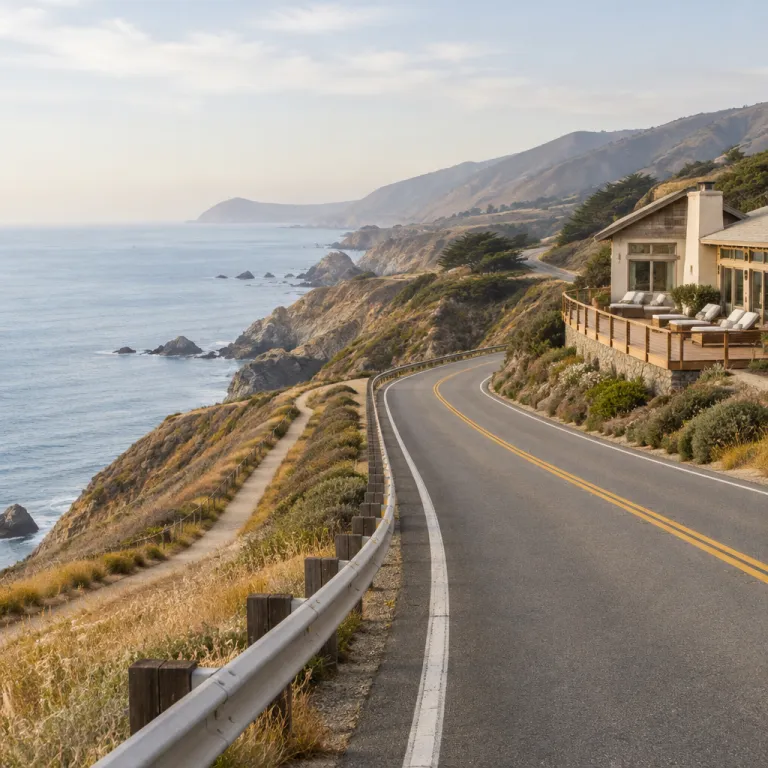
How far is Big Sur from San Francisco when you are planning a refined stay
The practical answer to how far Big Sur is from San Francisco is about 190 kilometres (around 120 miles) via the classic coastal route on Highway 1, according to typical Google Maps routing from central San Francisco to the Big Sur village area. This coastal distance feels shorter than it looks on a map, because every curve of the road reveals another Pacific panorama and another wild state beach. If you drive a more direct inland route, the one-way distance between the city and the Big Sur coast is broadly similar at roughly 190 to 210 kilometres, but you spend more time on faster highways and less on the dramatic cliffside sections and legendary bridges.
Most travellers choose the coast highway because it turns a simple transfer into a memorable road trip. From San Francisco you join Highway 1 near Pacifica, then follow the shoreline south past Half Moon Bay, Santa Cruz and the long curves of the west coast. The drive from San Francisco to the heart of Big Sur usually takes three to four hours of actual road time in normal conditions, based on Google Maps estimates, but you should plan at least six hours if you want to stop at a state beach, a lighthouse, or a coastal park along the way.
Traffic and daylight shape how far Big Sur feels from San Francisco in real terms. Leaving the city early in the morning avoids congestion near Santa Cruz and gives you more time to enjoy each mile of Highway 1 without rushing. If you are arriving for a hotel check in, allow a generous time buffer, because fog, road works or a photo stop at a famous bridge will almost certainly slow your trip.
Choosing your route: coast highway versus inland options through Monterey, Carmel and Santa Cruz
There are two main ways to cover the drive between San Francisco and Big Sur, and each road offers a different style of trip. The classic route follows the coast highway through Santa Cruz, then continues past the beaches of Monterey Bay and into the more rugged stretches of the Big Sur coastline. An inland alternative uses Highway 101 through Gilroy and Salinas before cutting across to the ocean near Carmel, which shortens the time spent on winding sections but sacrifices some of the great sea views.
For most guests who care about the journey as much as the hotel, the coastal road trip is the clear best choice. You pass long state beach stretches near Santa Cruz, then reach the refined towns of Monterey and Carmel by the Sea, where you can pause for lunch or even a night before continuing to your Big Sur hotel. If you are considering a multi stop itinerary, look at curated guides to coastal cities in California for a refined Big Sur stay, which help you decide whether Carmel, Pacific Grove or Monterey suits your style.
The inland route can still work well if your priority is to reach your Big Sur hotel in the shortest possible time. From San Francisco you follow Highway 101 south, then turn west near Salinas to reach Carmel and the beginning of the Big Sur coast in a more direct way. This option keeps the total driving distance similar in kilometres, but you spend fewer miles on the narrow cliffside highway and more on a faster state route, which some drivers find less tiring.
Iconic stops on the San Francisco to Big Sur road trip: bridges, beaches and state parks
Understanding how far Big Sur is from San Francisco also means understanding how many tempting stops lie between them. Once you pass Monterey, the road narrows and the landscape becomes dramatic, with steep cliffs dropping to the sea and the occasional sheltered state beach below. Every few mile markers you will see a pullout with a great view, and it is wise to build these pauses into your trip time.
One of the most famous landmarks on this stretch is Bixby Creek Bridge, often simply called Bixby Bridge, which arches gracefully over a deep canyon and frames the Pacific in both directions. Many travellers say that their first view of this bridge is the moment when the San Francisco to Big Sur road trip truly begins, because it signals the transition from gentle shoreline to wilder coastal mountains. A little farther south, you reach Point Lobos State Natural Reserve and Garrapata State Park, both of which offer short walks that help break up the journey from the city.
As you continue, Pfeiffer Big Sur State Park appears on the inland side of the road, offering redwood groves, river trails and a calm base if you choose a hotel nearby. Closer to the ocean, Pfeiffer Beach hides down an unmarked side road, rewarding patient drivers with purple tinged sand and powerful surf. South again, Julia Pfeiffer Burns State Park protects the famous McWay Falls, where a slender waterfall drops almost directly onto a tiny cove, and this view alone justifies adding extra time to your journey from San Francisco to Big Sur; if you are staying in the area, you can explore refined coastal experiences in nearby Pacific Grove through this detailed guide to things to do in Pacific Grove from a Big Sur stay.
Planning your Big Sur hotel stay: how distance from San Francisco shapes your itinerary
When you ask how far Big Sur is from San Francisco, you are really asking how to structure your entire coastal itinerary. The answer influences whether you book a single hotel in Big Sur and treat Monterey, Carmel and Santa Cruz as day trip destinations, or whether you divide your nights between several coastal towns. Because the drive from San Francisco is manageable in one day, many guests choose to travel down the coast highway in stages, turning the road trip itself into part of the holiday.
For a relaxed schedule, consider spending your first night in Monterey or Carmel by the Sea, then continuing to your Big Sur hotel the next day. This approach breaks the total distance from San Francisco into two shorter road segments and gives you time to enjoy the Monterey Bay Aquarium, Cannery Row, or a sunset walk along Carmel’s white sand beach. It also allows you to arrive in Big Sur earlier in the day, which is valuable because many properties are tucked into forested hillsides or perched above the ocean, and navigating the coastal highway after dark can feel demanding.
If you prefer to reach Big Sur in one continuous trip, plan your departure from San Francisco with precision. Leaving after the morning rush hour but before midday gives you the best balance between light traffic and ample daylight for photo stops at Bixby Creek Bridge, Pfeiffer Beach and McWay Falls. Always check current road conditions on the coast highway through official sources such as Caltrans, because landslides and maintenance can temporarily change how long the drive feels in terms of actual time behind the wheel.
Nearby Carmel and Monterey escapes: refined alternatives and complements to a Big Sur base
Some travellers realise that the relatively short drive between San Francisco and Big Sur makes it ideal to combine a stay in Big Sur with nights in Carmel or Monterey. Carmel by the Sea offers a walkable village atmosphere, art galleries and fine dining, which contrasts beautifully with the wilder feel of a forested Big Sur hotel. Monterey provides a slightly larger coastal city experience, with historic Cannery Row, a working harbour and easy access to family friendly state beach areas.
From a practical perspective, Carmel and Monterey sit roughly 30 to 45 kilometres north of the main Big Sur hotel cluster, which means you can reach them in under an hour on Highway 1 in typical conditions. This short hop from your Big Sur base makes them perfect for day trips when you want a change of pace without packing your bags. You might spend the morning hiking in Pfeiffer Big Sur State Park, then drive north for an afternoon of wine tasting in Carmel or a harbour cruise from Monterey, returning to your coastal retreat by evening.
These nearby escapes also help if you are planning a longer west coast road trip that continues toward Los Angeles or Santa Barbara. You can structure your route so that you travel from San Francisco to Monterey, then to Big Sur, and finally onward to the south, turning the entire coast highway into a curated bucket list of California experiences. Along the way, you will pass multiple bridges, state parks and beaches that each justify a stop, so think of Carmel and Monterey not as alternatives to Big Sur, but as complementary chapters in the same coastal story.
Extending the journey: from San Francisco and Big Sur toward Santa Barbara and Los Angeles
Once you understand how far Big Sur is from San Francisco, it becomes tempting to extend your itinerary farther down the coast. From the main Big Sur area to Santa Barbara, the distance is roughly 400 kilometres (about 250 miles) via Highway 1 and US 101, which translates into a full day of driving if you include pauses at viewpoints and state beach access points. Many travellers choose to break this segment with an overnight stop in San Simeon, Cambria or Pismo Beach, turning a long haul into another scenic road trip chapter.
From Santa Barbara to Los Angeles, the road distance is about 150 kilometres, and this final stretch of the west coast corridor feels more urban but still offers ocean views. If you began in San Francisco, stayed in Big Sur, and then continued to Santa Barbara and Los Angeles, you would have completed one of the classic California road trips, linking several of the state’s most celebrated coastal regions. In this context, the drive from San Francisco to Big Sur becomes just one part of a larger coast highway narrative that can easily fill a week or more.
When planning such an extended trip, consider how many nights you want in each destination rather than focusing only on kilometres and miles. A balanced itinerary might include two nights in San Francisco, two in Monterey or Carmel by the Sea, three in Big Sur, and then additional nights in Santa Barbara and Los Angeles. This structure respects the driving distance between each city, gives you time to enjoy key highlights like Bixby Creek Bridge, Pfeiffer Beach and McWay Falls, and ensures that your hotel stays feel like restful pauses rather than quick stops between long days on the road.
Practical tips for driving, timing and enjoying the San Francisco to Big Sur distance
Driving the route from San Francisco to Big Sur safely and comfortably requires a few practical considerations. The coast highway is a two lane road with sharp curves, steep drop offs and limited passing zones, so patience is essential, especially in peak season. Start your trip with a full fuel tank in San Francisco or Monterey, because petrol stations become sparse once you enter the more remote stretches of the Big Sur coast.
Weather can change quickly along this part of the west coast, and fog is common in the early morning and late afternoon. If visibility drops, slow down and use pullouts to let faster traffic pass, remembering that the goal is to reach your Big Sur hotel relaxed rather than rushed. For a refined break en route, consider stopping at a café or terrace with ocean views; curated guides to Big Sur coffee shops with views near your hotel can help you choose a spot that matches your style.
Finally, think about how the return journey from Big Sur to San Francisco fits into your overall travel plan. Some guests choose to drive back inland via Highway 101 to vary the scenery and reduce time on the winding coast highway, while others happily repeat the same coastal route to enjoy the bridges, state parks and beaches from a new perspective. Either way, treating the drive between San Francisco and Big Sur as an integral part of your holiday, rather than a simple transfer, will make your hotel stay feel richer and more connected to the landscape.
Key figures for the San Francisco to Big Sur journey
- The driving distance from central San Francisco to the main Big Sur village area via Highway 1 is approximately 190 kilometres (about 120 miles), which typically takes three to four hours without extended stops, based on Google Maps and California Department of Transportation travel estimates.
- The inland route from San Francisco to Carmel via Highway 101 and Highway 68 covers roughly 190 to 210 kilometres (120 to 130 miles), with average driving times of around two and a half to three hours in normal traffic, according to regional routing data.
- The distance from Big Sur to Santa Barbara along the coast highway is about 400 kilometres (around 250 miles), and most travellers allow seven to eight hours for this segment, including rest breaks and scenic stops, as recommended by major California road trip guides.
- The stretch of Highway 1 between Carmel and San Simeon, which includes Bixby Creek Bridge, Pfeiffer Big Sur State Park and Julia Pfeiffer Burns State Park, spans around 145 kilometres (about 90 miles) and is frequently cited by travel publications as one of the most scenic coastal drives in the United States.
- Traffic volumes on key sections of Highway 1 near Big Sur remain relatively low compared with urban freeways, often under 10,000 vehicles per day according to Caltrans traffic counts, which contributes to the route’s appeal but also means that closures due to landslides can significantly affect travel times when they occur.
FAQ about the distance from San Francisco to Big Sur
How long does it take to drive from San Francisco to Big Sur
Driving from San Francisco to the central Big Sur area via Highway 1 usually takes three to four hours without long stops, based on typical Google Maps estimates. Traffic, weather and photo breaks at viewpoints can easily extend this to five or six hours. Planning for a full day allows you to enjoy the scenery without rushing to your hotel.
Is the coastal road from San Francisco to Big Sur dangerous
The coast highway between Carmel and Big Sur is winding and narrow, with steep drop offs and limited guardrails in places. It is generally safe if you drive slowly, respect speed limits and use pullouts to let faster vehicles pass. Avoid driving this section in heavy fog or late at night if you are unfamiliar with mountain roads.
Can I visit Big Sur as a day trip from San Francisco
A day trip from San Francisco to Big Sur and back is technically possible but can feel rushed. You would spend six to eight hours driving, leaving limited time for hikes, state parks or relaxed meals. For a more comfortable experience, plan at least one night in Big Sur or nearby Monterey or Carmel by the Sea.
Do I need a car to travel from San Francisco to Big Sur
Having a car offers the greatest flexibility for stopping at beaches, bridges and state parks along the route. Public transport options are limited and do not cover the full Big Sur coast in a practical way for hotel guests. Many visitors rent a car in San Francisco specifically to enjoy this section of the California coast highway.
When is the best time of year to drive between San Francisco and Big Sur
Late spring and early autumn often provide the best balance of mild weather, clearer skies and lighter traffic. Summer brings longer daylight hours but also more visitors and potential congestion near popular beaches and parks. Winter can be beautiful yet occasionally affected by storms and landslides, so always check road conditions with Caltrans or local authorities before you travel.