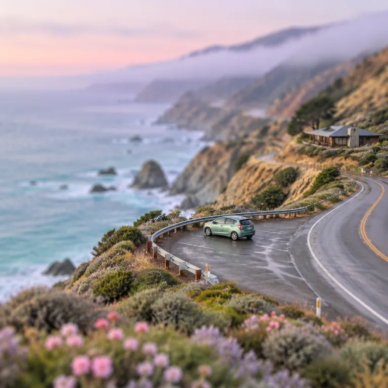
Big Sur safety tips for drivers planning a coastal hotel stay
Big Sur safety tips for drivers start long before you reach the coast. When you plan a road trip along the Pacific Coast Highway, check official road conditions and current closures or one-way traffic controls through tools such as Caltrans QuickMap and the California Department of Transportation (Caltrans) website. This early preparation helps you choose the best hotel location in the region and avoid stressful detours or unexpected backtracking on the first day.
Highway 1 in central California is a narrow coastal highway with steep cliffs, tight curves, and changing road conditions that can surprise even confident drivers. Before you book a hotel in Big Sur or elsewhere on the coast, review Caltrans updates for conditions on the highway and any current restrictions affecting access to your chosen state park or national park. Matching your hotel reservation to the most stable section of the coast highway reduces the risk that a slide or storm will cut you off from your room or from key sights such as McWay Falls at Julia Pfeiffer Burns State Park or Bixby Creek Bridge; for example, the 2017 Mud Creek slide closed a long stretch of Highway 1 for more than a year, and more recent storms have triggered multi-day closures near Big Sur Village.
Many visitors underestimate how long a drive through Big Sur can take. Even a short road trip from Ragged Point to Julia Pfeiffer Burns State Park can stretch into hours when conditions on the highway are wet, foggy, or under construction. Build generous time buffers into each trip segment, especially if you are arriving at a coastal hotel after dark, because night driving on this route is far more demanding than a daytime drive on a wide inland state highway; allow at least 30 to 50 percent more time than your navigation app suggests so you can slow for construction zones, photo stops, and temporary traffic controls.
Seasonal travel patterns on Highway 1 and how they affect hotel choices
Seasonal travel patterns on Highway 1 shape both road conditions and hotel availability in Big Sur. In winter and early spring, Pacific storms can trigger slides that close long stretches of the coast highway, so safe trip-planning always includes checking current conditions on Caltrans QuickMap before committing to a non-refundable room. During these months, you may prefer a hotel near a state park or town with alternative inland access, such as Carmel, Monterey, or Cambria, rather than a remote point along the most slide-prone cliffs.
Summer brings the highest visitor numbers to central California, which means more traffic on every coastal drive and fewer last-minute hotel options. Day trippers from across the state crowd popular viewpoints such as Bixby Creek Bridge, McWay Falls, and Ragged Point, slowing the flow of cars along the Pacific Coast and increasing the risk of distracted driving. If you plan a summer road trip, reserve a room with on-site parking and study a detailed guide to Big Sur that explains where congestion usually peaks and how early you should leave your hotel for sunrise or sunset drives; in peak months, expect the heaviest traffic between roughly 10 a.m. and 4 p.m., especially on weekends and holiday periods.
Shoulder seasons can offer the best balance between calmer road conditions and quieter hotels. In late spring and autumn, the region often enjoys clear coastal views, more predictable conditions on the highway, and easier access to state park trailheads without the intense midday crowds. To align your stay with the safest and most scenic driving windows, review a month-by-month overview of Big Sur weather, then match your booking dates to your preferred driving style and daylight hours; for instance, in May and October you often gain more consistent visibility and can schedule longer drives in the middle of the day while keeping early mornings for short hops from your hotel to nearby viewpoints.
Choosing the right hotel location for safer drives in Big Sur
Where you sleep in Big Sur strongly influences how safely you can drive each day. A hotel near a central point on the coast highway reduces the distance you must cover on any single drive, which is especially helpful when road conditions are uncertain or when fog rolls in from the Pacific. Many safety recommendations emphasize limiting night driving, so aim for a location that lets you reach key sights such as McWay Falls, Julia Pfeiffer Burns State Park, Pfeiffer Big Sur State Park, and Bixby Creek Bridge during daylight, ideally with no more than 60 to 90 minutes of driving between your lodging and your furthest planned stop.
Some travelers prefer to stay near a state park entrance, such as Pfeiffer Big Sur State Park or another coastal state park, to minimize early morning driving before coffee and breakfast. Others choose lodging near Ragged Point or closer to the northern gateway of the region to shorten the initial approach from major California cities. When comparing options like a clifftop inn near Ragged Point, a creek-side lodge near Bixby Creek, or a property near a national-park-style landscape inland, consider how each location affects your daily drive times, fuel stops, and access to emergency services; program key numbers such as 911 for emergencies and the non-emergency line for the local sheriff’s office into your phone before you set out.
Hotel amenities also play a subtle role in road safety. If your property offers reliable on-site dining, you are less likely to attempt a late-night drive along the coast highway in search of dinner after a long day of sightseeing. For guests who care about starting each road trip segment with a proper meal, a guide to how hotel location shapes your search for the best breakfast in Big Sur can help you choose a base that supports alert, well-timed departures and safer driving habits; in remote stretches, confirm breakfast and dinner hours in advance so you are not tempted to drive tired in fading light.
Iconic viewpoints, parking safety, and managing crowd pressure
Driving safety becomes especially important at iconic viewpoints where scenery competes with concentration. Bixby Creek Bridge, McWay Falls, and Ragged Point attract heavy traffic, and the mix of rental cars, tour vans, and pedestrians can create sudden hazards on the narrow road. Plan your trip so that you reach these points early in the day or later in the afternoon, when parking turnover is higher and the flow of vehicles along the coast highway is slightly calmer; arriving around sunrise or within the last two hours of daylight often means fewer crowds and less pressure to squeeze into marginal spaces.
Never stop in the travel lane or on blind curves to take photos of the Pacific Coast, no matter how tempting the view. Use only designated turnouts and parking areas, even if that means skipping a crowded pullout and returning later from your hotel base for a second drive. At popular state park entrances, such as Julia Pfeiffer Burns State Park, Pfeiffer Big Sur State Park, or other coastal parks in central California, be prepared for full lots and obey all instructions from rangers managing current conditions and traffic flow; if a lot is closed or full, continue to the next safe turnout rather than circling or blocking the entrance.
Whale watching season adds another layer of complexity to road conditions along the region. Drivers often slow abruptly when someone spots a spout offshore, which can trigger rear-end collisions if you are following too closely on the winding coast highway. To align your hotel search and daily driving plans with these seasonal wildlife patterns, schedule your viewing stops at safe, well-signed points and established turnouts rather than reacting impulsively from behind the wheel, and remind everyone in your vehicle to keep scanning for brake lights as well as for whales.
Weather, daylight, and reading the road in the sur region
Weather shifts quickly along the Big Sur coast, and drivers must adapt just as fast. Marine fog can reduce visibility to a few metres on the coast highway, while inland hills remain clear and bright under the California sun. Before each day’s drive, check both the marine forecast and inland current conditions, then adjust your departure time from the hotel to match the safest window; if dense fog persists, consider delaying your longest segment until midday and using the morning for short walks or local viewpoints near your lodging.
Rain transforms road conditions on Highway 1, especially near steep slopes and creek crossings. When storms hit central California, debris can wash across the road near places like Bixby Creek or other small creek bridges, and the risk of slides increases near Julia Pfeiffer Burns State Park and similar terrain. If you encounter active slides or see crews managing conditions on the highway, follow their instructions, slow well below the posted limit, and consider turning back to your hotel rather than pushing through marginal conditions; Caltrans QuickMap and highway message signs often indicate whether closures are expected to last hours, days, or longer.
Daylight management is another core element of safe driving in Big Sur. Plan your longest road trip segments for the middle of the day, when glare is manageable and you can clearly read the curves and camber of the road. Reserve only short, familiar drives for dusk or dawn, and if your hotel is far from services, refuel before sunset so you are not forced into an unnecessary night drive along the Pacific Coast in search of an open station; many small stations close by early evening, and mobile coverage can be patchy if you need assistance.
Practical driving strategies and how hotels can support safer trips
Safe driving in Big Sur is as much about behaviour as it is about conditions. Maintain a generous following distance on every coastal drive, because the car ahead may brake suddenly for wildlife, fallen rocks, or a surprise viewpoint. Use turnouts frequently to let faster vehicles pass, especially if you are enjoying a leisurely road trip and want to savour the Pacific Coast scenery; California law encourages slower vehicles with several cars behind them to pull over at designated turnouts when it is safe.
Hotels can actively support visitors by sharing up-to-date information about road conditions and any closures affecting access to the region. Many front desks monitor official state highway updates, including Caltrans QuickMap, and can advise whether a particular state park, such as Julia Pfeiffer Burns State Park, Pfeiffer Big Sur State Park, or another coastal park, is reachable that day. When you check in, ask staff for a printed or digital guide that highlights safe turnouts, fuel stops, and realistic drive times between major points like Ragged Point, Bixby Creek Bridge, and McWay Falls, and confirm which direction currently offers the most reliable access if storms or slides have affected one end of the corridor.
Finally, align your personal limits with the realities of the coast highway. If you are unused to mountain roads, consider breaking the journey into shorter segments with an overnight stay in central California before tackling the most dramatic cliffs of Big Sur. Choosing a hotel with flexible cancellation policies and clear communication about current conditions on Highway 1 gives you the confidence to adjust plans without feeling pressured into unsafe decisions behind the wheel, and allows you to pause for a night in a safer town if Caltrans or local law enforcement recommends avoiding travel.
Key statistics on Big Sur travel, safety, and Highway 1
- The California Department of Transportation reports that certain segments of Highway 1 in Big Sur experience multiple weather-related closures most years, often lasting several days at a time, which underscores the need to check current conditions on Caltrans QuickMap before any road trip; for instance, winter storms in recent years have repeatedly closed the highway near Big Creek Bridge and Limekiln State Park.
- Data from the California Office of Traffic Safety show that rural two-lane roads, such as much of the coast highway through the region, have higher rates of fatal crashes per vehicle mile (or kilometre) travelled than urban freeways, largely due to curves, limited shoulders, and driver inattention; this pattern reinforces the importance of slower speeds, wider following distances, and consistent use of turnouts.
- Visitor statistics from California State Parks indicate that popular units in and around Big Sur, including Julia Pfeiffer Burns State Park, Pfeiffer Big Sur State Park, and other coastal parks, receive well over a million visitors annually, concentrating traffic and parking pressure into peak months and peak hours of the day; on busy summer weekends, lots at marquee trailheads can fill by mid-morning.
- Tourism reports for central California note that average hotel occupancy along the Pacific Coast can exceed 80 percent during summer weekends, which reduces flexibility for drivers who might otherwise adjust their itineraries in response to sudden changes in road conditions; booking cancellable rates and confirming policies with your hotel can preserve options if Caltrans announces a new closure on short notice.
FAQ about Big Sur safety tips for drivers and hotel planning
What is the safest time of year to drive Highway 1 in Big Sur ?
The safest periods to drive Highway 1 in Big Sur are usually late spring and autumn, when storms are less frequent and summer crowds have thinned. During these seasons, road conditions on the coast highway are often more stable, and you can secure hotel reservations without the intense competition of peak summer. Always confirm current conditions with California transportation authorities, such as Caltrans QuickMap, and your chosen hotel before finalizing dates, especially if you plan to visit shortly after a major winter storm.
How much driving should I plan per day in Big Sur ?
For most visitors, planning no more than 100 to 125 miles (160 to 200 kilometres) of coastal driving per day in Big Sur keeps fatigue manageable. The road is winding, with frequent curves and changing speeds, so distances take longer than on a typical state highway. Build extra time into your schedule for photo stops at places like Bixby Creek Bridge or McWay Falls, and aim to reach your hotel well before dark so you can check in, refuel, and eat dinner without rushing.
Do I need a special vehicle to handle Big Sur road conditions ?
You do not need a special vehicle for Big Sur in normal weather, but a well maintained car with good brakes and tyres is essential. Compact and midsize vehicles are often easier to handle on tight curves and in small parking areas at state park trailheads. In wet or stormy conditions, any vehicle requires slower speeds and greater following distances on the coast highway, and you should avoid driving through standing water or debris that could hide potholes or rocks.
How can my hotel help me stay informed about closures and detours ?
Many hotels in the region monitor official updates on conditions on Highway 1 and share alerts with guests at check in or via email. You can ask the front desk for printed maps showing current closures, safe detours, and realistic drive times between major points. Choosing a property that proactively communicates about road conditions, using sources such as Caltrans QuickMap and local law enforcement advisories, adds an extra layer of safety to your trip and helps you decide whether to adjust your daily route or departure time.
Is night driving along the Big Sur coast highway recommended ?
Night driving on the Big Sur section of Highway 1 is generally not recommended for first time visitors. The road has limited lighting, sharp curves, and frequent wildlife crossings, which are harder to anticipate in the dark. Plan your itinerary and hotel stays so that most of your driving occurs in daylight, reserving only short, familiar segments for early morning or evening, and carry a flashlight and reflective clothing if you expect to walk between parking areas and your room after sunset.