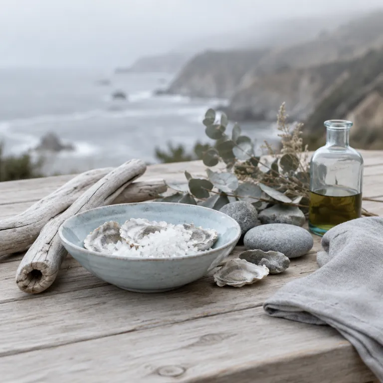
Understanding how far Big Sur is from San Francisco, California
The distance from San Francisco to Big Sur along the Pacific coast is about 190 kilometres (roughly 118 miles) by road. This coastal journey follows Highway 1 and connecting routes and is widely regarded as one of the most scenic drives in California, so the time on the road becomes part of your trip rather than just a transfer. When you think about how far Big Sur is from San Francisco, California, remember that driving time and road conditions matter more than the raw distance between city and coastline.
Most travellers drive from San Francisco to Big Sur in around three to four hours in normal conditions, according to typical Google Maps routing estimates, with variations based on traffic and how often they stop for photos or a state beach walk. The quickest option usually combines US-101 and Highway 156 before joining Highway 1 near the Monterey Bay area, while the most scenic route follows the Pacific Coast Highway from San Francisco almost the entire way. If you are choosing a hotel, this expected driving time will shape your itinerary, your arrival window, and even which part of Big Sur feels most convenient for your plans.
Highway 1 between Carmel and Big Sur is a narrow, winding coastal road with curves, steep cliffs, and unforgettable views of the Pacific Ocean. Because of this, the real distance from San Francisco can feel longer than the kilometres suggest, especially if you pause at each bridge or state park overlook. Many guests treat the drive as the first chapter of their trip, stopping at a state beach, a park trailhead, or a quiet beach cove before they even check into their Big Sur hotel.
Choosing your route via Carmel, Monterey, and Santa Cruz
When you calculate how far Big Sur is from San Francisco, California, you also choose between a more direct inland-style drive and a slower, more scenic coastal road trip. The inland-leaning option via US-101 and Highway 156 is usually shorter in time, while the shoreline route through Santa Cruz, Monterey, and Carmel is richer in viewpoints and classic Pacific Coast Highway stops. For many travellers, the chance to pause in Carmel and Monterey turns a simple transfer into a full day trip filled with coastal detours.
Driving from San Francisco through Santa Cruz adds only modest distance from the city, yet it opens access to long state beach stretches and relaxed surf towns along the Monterey Bay. From Santa Cruz you follow the coast highway south, passing state park turnoffs and viewpoints before reaching the Monterey Peninsula and the elegant streets of Carmel-by-the-Sea. If you are considering refined coastal stays between Monterey and Big Sur, detailed guidance on stays along California’s dramatic edge can help you decide where to pause before continuing to Big Sur.
From Carmel to Big Sur, the distance from town to the heart of the region is roughly 40 kilometres (about 25 miles) along a winding section of Highway 1. This stretch of the Pacific Coast Highway includes the iconic Bixby Creek Bridge, one of the most photographed bridges in California, and several state park entrances. Because the road is narrow and the views are distracting, allow generous time so that your visit to Big Sur begins relaxed rather than rushed.
Iconic stops along the Pacific Coast Highway
Understanding how far Big Sur is from San Francisco, California also means knowing which stops justify slowing your pace along the way. Between San Francisco and Big Sur, the Pacific Coast Highway passes rugged cliffs, sheltered beach coves, and state park trailheads that can easily fill a full day of exploring. If you are staying in a hotel in Big Sur, you can treat the drive down as the scenic half of a longer road trip and the drive back as a second chapter with different viewpoints and beaches.
One of the most celebrated landmarks on this route is Bixby Creek Bridge, which spans a deep canyon and frames the Pacific coast in a single sweeping curve. Many travellers pause at the viewpoints north and south of the bridge to photograph the coast and to appreciate how the coastal highway clings to the cliffs. Because parking is limited and turnouts are small, it is wise to plan your itinerary so that you reach Bixby Creek during quieter times of the day.
Farther south, Julia Pfeiffer Burns State Park is home to McWay Falls, where a slender waterfall drops directly onto a small state beach framed by turquoise water. The short trail to the McWay Falls overlook offers some of the best views in Big Sur, and it is an easy addition to any visit to the area, whether you are staying nearby or continuing your road trip. When you compare Big Sur versus Monterey for your coastal stay, resources such as this analysis of how to choose the best coastal stay can help you decide where to spend more nights and how to structure your driving days.
How driving distance shapes your Big Sur hotel choice
The answer to how far Big Sur is from San Francisco, California directly influences where you should book your hotel along the coast. If you prefer a shorter first day, you might stay near Carmel or Monterey and then continue to Big Sur the next morning when traffic is lighter and the light is softer for photography. Travellers who enjoy longer drives may choose to reach the central Big Sur area in one stretch, arriving in time for sunset views from their room, terrace, or nearby overlook.
Hotels in the northern part of Big Sur, closer to Bixby Creek Bridge and Carmel, suit guests who plan frequent day trips back to Carmel, Monterey, or even Santa Cruz. From these properties, the distance from your room to the Monterey Peninsula is modest, which makes restaurant reservations and cultural outings easy to combine with coastal hikes and beach walks. Guests who want a more secluded experience often select hotels farther south near Julia Pfeiffer Burns State Park or near Pfeiffer Beach, accepting a longer drive from San Francisco in exchange for quieter nights and darker skies.
When you plan your itinerary, consider how many times you will drive the same Highway 1 segments between your hotel, each state park, and each beach. A central location can reduce repeated driving, while a more remote hotel can immerse you in the sounds of the Pacific coast and the scent of redwoods. For travellers timing their stay with whale watching season, specialised advice on where to stay for Big Sur’s whale season can help you match your hotel choice to the best viewing areas along the coast highway.
Nearby Carmel and Monterey escapes for refined stays
Many guests asking how far Big Sur is from San Francisco, California are really deciding whether to split their nights between Big Sur and the Carmel or Monterey area. Carmel offers a walkable village atmosphere, art galleries, and access to the calm waters of Carmel Bay, while Monterey provides a historic waterfront and the renowned Monterey Bay Aquarium. Both areas sit north of Big Sur, which shortens the distance from San Francisco on your arrival day and allows a gentler start to your coastal road trip.
From Carmel to Big Sur, the road distance is short but the scenery is intense, with each curve revealing new views of the Pacific coast and the rugged cliffs of California. Staying in Carmel or Monterey first lets you adjust to the slower pace of the Pacific Coast Highway before you continue south past Bixby Creek Bridge and into the heart of Big Sur. This pattern works well for travellers who want to visit Big Sur’s state park network by day and return to a broader choice of restaurants and evening activities at night.
Some visitors choose the reverse, spending their first nights in Big Sur and then moving north to Carmel or Monterey for a final night closer to San Francisco. This approach reduces the distance from your last hotel to the airport or city, which can be reassuring before an early flight or a tight schedule. Whether you stay in one place or several, think of Carmel, Monterey, Santa Cruz, and Big Sur as complementary coastal chapters rather than competing destinations.
Planning your time in Big Sur’s parks, beaches, and viewpoints
Once you understand how far Big Sur is from San Francisco, California, the next step is to allocate time among beaches, state parks, and scenic stops. Pfeiffer Beach, with its purple sand tones and sea arch, lies down a narrow side road and rewards patient drivers with dramatic sunset views and crashing surf. Nearby, Pfeiffer Big Sur State Park and Julia Pfeiffer Burns State Park offer redwood groves, river trails, and the famous McWay Falls overlook, each requiring at least a few hours to appreciate fully.
Because parking at each state park and state beach is limited, arriving early or later in the afternoon can transform your experience. Many hotel guests plan a flexible itinerary that alternates between longer hikes in the morning and shorter beach visits or bridge viewpoints in the late day. This rhythm allows you to enjoy the best light on the Pacific coast while avoiding the most crowded times at popular stops such as Bixby Creek Bridge and the McWay Falls trail.
When you visit Big Sur, remember that the coastal highway is part of the attraction, not just a way to move from one park to another. Distances between trailheads, beaches, and viewpoints may look small on a map, but the curves and frequent photo stops extend travel time. Building generous margins into your schedule will keep your road trip relaxed and leave space for unplanned moments, such as a quiet beach walk or an impromptu stop at a roadside café.
Seasonality, safety, and practical tips for the coastal drive
The experience of how far Big Sur is from San Francisco, California changes with the season, the weather, and the condition of the Pacific Coast Highway. Winter storms can cause temporary closures or delays along Highway 1, while summer brings heavier traffic and more competition for parking at each state park and state beach. Before you set out, check official California Department of Transportation (Caltrans) updates so that your itinerary reflects current road conditions and any active construction zones.
Driving this stretch of the Pacific coast requires attention, especially near Bixby Creek Bridge and other cliffside segments where the road narrows and sightlines can be limited. Plan regular breaks at safe turnouts or park entrances rather than stopping on the shoulder, and allow extra time when travelling from San Francisco on weekends or holidays. If you are not comfortable with winding roads, consider staying in Carmel or Monterey and visiting Big Sur’s highlights as shorter day trips rather than a single long drive.
For hotel guests, practical details such as fuel, food, and mobile coverage also shape the perception of distance from San Francisco. Fill your tank before leaving larger towns like Carmel or Monterey, and carry water and snacks in case traffic slows near a bridge or park entrance. With thoughtful planning, the road between San Francisco and Big Sur becomes a memorable part of your coastal journey rather than a hurdle between you and your chosen hotel.
Key figures for the San Francisco to Big Sur coastal journey
- The driving distance from central San Francisco to the Big Sur village area via Highway 1 and US-101 is roughly 190 kilometres (about 118 miles), which typically takes three to four hours in normal traffic according to Google Maps routing data.
- The stretch from Carmel to the central Big Sur area is about 40 kilometres (around 25 miles) along the Pacific Coast Highway, but drivers often spend 60 to 90 minutes on this segment because of curves, viewpoints, and traffic near Bixby Creek Bridge.
- Julia Pfeiffer Burns State Park, home to McWay Falls, lies approximately 55 to 60 kilometres (34 to 37 miles) south of Carmel by road, which makes it a comfortable half-day excursion for travellers staying in Carmel or Monterey.
- Highway 1 closures due to landslides or storm damage have occurred multiple times over the past decade, with some repair projects lasting several months, so checking California Department of Transportation (Caltrans) updates before travel is essential.
- Parking at popular Big Sur locations such as Pfeiffer Beach and Julia Pfeiffer Burns State Park can fill by late morning on peak weekends, leading to wait times of 20 to 40 minutes during busy periods according to local visitor reports and park advisories.
FAQ about travelling from San Francisco to Big Sur
How long does it take to drive from San Francisco to Big Sur ?
The drive from San Francisco to the central Big Sur area usually takes three to four hours, depending on traffic, weather, and how many stops you make along the Pacific Coast Highway. Travellers who pause frequently at state parks, beaches, and viewpoints should allow a full day for the journey. Leaving early in the morning often reduces congestion near Santa Cruz, Monterey, and Carmel.
Is the road from San Francisco to Big Sur difficult to drive ?
Highway 1 between Carmel and Big Sur is winding, narrow in places, and runs along cliffs, which can feel challenging for some drivers. In dry, clear conditions, most confident drivers manage it comfortably by keeping speeds moderate, using designated turnouts for photos, and respecting advisory speed signs. If you are nervous about heights or curves, consider staying in Carmel or Monterey and limiting your Big Sur driving to shorter segments.
Do I need a car to visit Big Sur from San Francisco ?
A car is the most practical way to travel from San Francisco to Big Sur because public transport options are limited and do not cover the full coastal stretch. Some visitors join organised day tours, but these allow less flexibility for hotel stays, photo stops, and personalised itineraries. Renting a car gives you control over your schedule, your preferred viewpoints, and your choice of hotel locations.
Where should I stay if I want to explore both Big Sur and Carmel ?
Travellers who want to explore both Big Sur and Carmel often split their stay, spending a few nights in each area. Carmel offers easier access to restaurants, shops, and cultural attractions, while Big Sur provides immersion in nature and closer proximity to state parks and beaches. This combination keeps daily driving distances modest while still allowing you to experience the full character of the central California coast.
When is the best time to plan a Big Sur road trip from San Francisco ?
Late spring and early autumn usually offer the best balance of mild weather, clearer skies, and lighter traffic on the Pacific Coast Highway. Summer brings warmer temperatures but also more visitors, which can increase driving times and reduce parking availability at popular state parks and beaches. Winter can be dramatic and beautiful, yet storms sometimes cause temporary road closures, so flexible plans and up-to-date information from Caltrans are important.