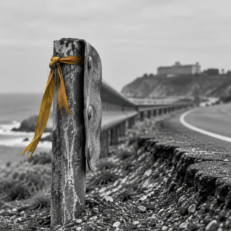
Is Highway 1 open to Big Sur when you want to travel ?
Anyone asking whether Highway 1 is open to Big Sur is really asking whether their coastal escape will feel relaxed or stressful. The answer shifts with each winter storm, each new construction project, and every slide that reshapes this fragile stretch of California coast highway. Before you book a room in Big Sur, you need to understand how the current highway open status, the coastline itself, and ongoing repair work will affect your travel time along this dramatic corridor.
Highway 1 is a lifeline for Big Sur, and access can change quickly between Monterey in the north and San Luis Obispo in the south. After heavy rain, a slide can close a key point on the route, leaving some hotels reachable only from the north or only from the south, or in rare cases cut off to regular guests. When you check travel updates, always confirm not just whether the road is technically open, but from which direction you can reach your chosen area of Big Sur without major delays.
Caltrans, the California Department of Transportation, provides the most reliable real time information on closures, controlled one way traffic, and expected slowdowns. Their official tools on the ca dot gov domain list each work zone, the current status, and whether the coast remains passable for visitors heading toward Big Sur. When you see a note about construction, controlled traffic, or lane reductions, factor that into your arrival time, your dinner reservations, and even your choice between a northbound or southbound approach to the coast.
How seasonal slides and construction zones affect where you should stay
Winter storms along the Big Sur coast often trigger a slide that can close the highway at a narrow point carved into the cliffs. When that happens, Caltrans crews move in with heavy equipment, and construction work can last for more than a week, sometimes creating long controlled traffic sections with noticeable delays. During these periods, the road may be technically open in sections, but the disruption can completely change which hotel location makes sense for your stay.
When a closure sits between your hotel and either Monterey to the north or San Luis Obispo to the south, your driving time can double, and your plans for day trips may no longer feel realistic. A property that looked perfect on a map might become impractical if the only usable segment of the coast highway forces you to loop inland via east side routes. This is why many seasoned travelers now check Caltrans travel updates first, then choose their Big Sur hotel based on which side of the construction work they prefer to stay and how the highway big picture looks for that week.
For guests planning a broader California road trip, the question is not only whether Highway 1 is open near Big Sur, but how the overall route will shape each overnight stop. If a slide has closed the coast highway south of Big Sur, you might base yourself near Carmel and treat Big Sur as a day trip from the north. For a deeper planning guide on how Highway 1 conditions influence lodging choices along the coast, see this detailed resource on the Big Sur California road trip and how Highway 1 shapes your hotel choice.
Seasonal travel patterns on Highway 1 and what they mean for your booking dates
Highway 1 around Big Sur follows a clear seasonal rhythm that should guide when you book your stay. Late autumn through early spring brings the highest risk of a slide, partial closures, and long controlled traffic zones that create frustrating delays. In contrast, late spring and summer usually offer more stable highway open conditions, but also heavier visitor numbers and higher room rates along the coast.
When you consider whether the road will be open during your preferred week, you should also ask how crowded it will feel. Summer weekends can see slow moving lines of cars along the coast highway, especially at narrow construction points where Caltrans maintains one lane with alternating north and south traffic. If you value quiet, consider midweek stays in shoulder seasons, when the coast remains accessible, traffic is lighter, and hotels often have more flexible cancellation policies in case the current highway situation changes.
Weather patterns matter as much as the calendar, because a single intense storm from the east can undermine the road base and trigger emergency work. Before locking in non refundable reservations, compare your planned dates with historical rainfall and temperature trends for Big Sur from sources such as NOAA climate summaries. A practical way to align your hotel booking with likely road and weather conditions is to consult a month by month climate overview such as this guide to how Big Sur weather by month shapes your hotel stay, then cross check with current Caltrans travel updates.
Reading Caltrans and dot gov travel updates like a seasoned Big Sur guest
Many travelers glance at a map, see a blue line along the coast, and assume the highway is clear, but Big Sur demands a more careful approach. When you check the Caltrans QuickMap or the official California dot gov pages, look closely at each red or yellow icon along the coast highway between Carmel and San Luis Obispo. Each symbol represents a current condition, whether a full closure, controlled one way traffic, or a minor work zone that may still cause delays during peak hours.
If you want to know whether Highway 1 is open to Big Sur today, focus on three details in the travel updates. First, note the exact mile markers or named landmarks that define the closed or controlled area, then compare them with your hotel’s location north or south of that point. Second, read the estimated reopening date or work schedule by day of the week, because some construction projects pause on weekends while others run seven days, changing how your time on the road will feel.
Third, pay attention to whether the coast remains accessible from at least one direction, even if the highway big picture shows a closure symbol. A hotel south of a slide may still be reachable from San Luis Obispo, while a property to the north might only be accessible from Monterey, so your arrival airport and car rental plans may need to shift. Treat these real time updates as dynamic tools, checking them again a few days before departure and once more on the morning you drive into Big Sur.
Choosing the right Big Sur hotel when Highway 1 is partially closed
When the answer to whether Highway 1 is fully open near Big Sur is “partly”, your hotel choice becomes a strategic decision rather than a simple preference. Start by mapping your must see points along the coast, such as Bixby Creek Bridge to the north or McWay Falls farther south, then see which segments of the highway remain open for easy access. If a slide has cut the road near a central point, you may want to stay on the side that offers the most of your planned experiences without repeated backtracking through controlled traffic zones.
Guests who care about dining variety should also consider how closures affect restaurant access along the coast highway. Some of Big Sur’s most sought after restaurants sit in a compact area, and a construction closure just north or south can turn a short drive into a long detour or even make a dinner reservation unrealistic. For a deeper look at how location shapes your daily rhythm, including where you will enjoy your first meal of the day, consult this guide on how hotel location shapes your search for the best breakfast in Big Sur.
Parking and on site services also matter more when the highway conditions are unstable, because you may choose to stay on property during periods of heavy work or rain. Look for hotels that clearly communicate their own access status, including whether guests should arrive from the north or from the south based on the latest Caltrans guidance. When a property shares timely travel updates and explains how the coast remains reachable despite a nearby slide, it signals a level of operational maturity that can make your stay feel calm even when the broader highway situation is changing.
Practical timing, real time checks, and how to protect your stay
Even when the official answer to whether Highway 1 is open near Big Sur is yes, the timing of your drive can shape your entire arrival experience. Aim to pass through any known construction or controlled traffic areas outside the busiest hours, ideally midmorning or midafternoon, when delays tend to be shorter. Night driving along this coast highway is possible, but the combination of darkness, narrow shoulders, and potential rockfall from the steep slopes to the east makes it less comfortable for many visitors.
Build extra time into your schedule, especially if you are driving between San Luis Obispo and Big Sur or between the Monterey Peninsula and the southern area of the coast. A segment that looks like a two hour drive on a map can stretch to three hours or more when a slide repair has reduced the highway to one lane with alternating north and south traffic. Check real time conditions on Caltrans tools shortly before departure, then call your hotel to confirm that their access route matches the latest travel updates and that the coast remains open in practice, not just on paper.
Flexible booking terms are your best protection against sudden closures, because even expert forecasts cannot predict every slide or emergency work order. When possible, choose rates that allow date changes if the highway open status shifts dramatically in the week before your trip. By pairing careful real time monitoring with thoughtful hotel selection and generous timing, you can enjoy the full drama of Big Sur while respecting the living, shifting nature of this extraordinary stretch of the California coast.
Key figures on Highway 1 and Big Sur access
- Highway 1 between Carmel and San Luis Obispo spans roughly 145 miles (about 230 kilometres), a distance that typically takes about four to five hours to drive in clear conditions without major construction or controlled traffic zones, according to Caltrans travel time estimates.
- Caltrans reports that certain Big Sur segments have experienced multiple significant slides in recent decades, with some closures lasting several weeks or longer, which directly affects hotel occupancy patterns and booking windows along the coast.
- Average annual rainfall in the Big Sur area ranges from about 500 to more than 1 000 millimetres depending on elevation, based on long term NOAA climate data, with the wettest months strongly correlated with the highest risk of slide related highway closures.
- Tourism data from Monterey County shows that visitor numbers to the Big Sur region can drop sharply during extended Highway 1 closures, then rebound quickly once the highway open status is restored, underscoring the importance of real time travel updates for both guests and hoteliers.
- Driving speeds along the most winding Big Sur stretches often average only 25 to 35 miles per hour (about 40 to 55 kilometres per hour), meaning that even short additional delays from construction or controlled traffic can significantly extend overall travel time between key points on the coast.
FAQ about Highway 1 access and Big Sur hotel planning
How can I check if Highway 1 is open to Big Sur before I book ?
Use the official Caltrans QuickMap and California Department of Transportation pages on ca dot gov to see current closures, controlled traffic zones, and construction work between Carmel and San Luis Obispo. Then contact your preferred hotel directly to confirm the best north or south approach based on the latest information.
What happens to my hotel booking if a slide closes Highway 1 suddenly ?
Policies vary by property, so always review cancellation and change terms before confirming. Many Big Sur hotels will work with guests when a major slide or emergency closure makes access impossible, but flexible rates give you the most protection.
Is it better to approach Big Sur from the north or from the south ?
The best direction depends on the current highway conditions and your broader California itinerary. When closures sit south of Big Sur, approaching from Monterey in the north is usually easier, while closures north of the area may make an approach from San Luis Obispo in the south more practical.
Are there specific times of year when Highway 1 is more likely to close ?
Closures are more common during the wettest months, when heavy rain can trigger slides and undermine the roadbed. Late spring through early autumn generally sees fewer major disruptions, although localized construction work and controlled traffic can occur at any time.
Should I avoid driving Highway 1 at night when staying in Big Sur ?
Many visitors prefer to drive this coast highway during daylight because of the narrow lanes, sharp curves, and potential rockfall from steep slopes. If you must arrive after dark, allow extra time, drive cautiously, and check real time travel updates to avoid unexpected delays.